 Loading... Please wait...
Currency Displayed in
- Home
- Travel Maps
- Norway Travel Map
Categories
Related Products
-
 Victoria Map Travel Map $9.95
 -

-

-
 Bolivia Map Travel Map $9.95
 -
 Norway itmb Travel Map $9.95

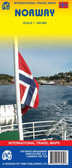
Norway Travel Map
 is in an attached booklet, which also contains simple street plans of Trondheim, Hammerfest, Bergen, Oslo, Narvik and Stavanger.")
Hover over image to zoom
)
Product Description
Freytag double-sided, folded road map of Norway at 1:600,000. Map includes city maps for Bergen, Hammerfest, Oslo, Narvik, Stavanger and Trondheim, index with postal codes & distances in km. Great quality map to buy for your travels through Norway.
New edition of this map, now with hill shading showing the general relief. This is a double-sided map, with the northern part of the country divided into 3 sections to fit it conveniently onto the sheet.
Road detail includes secondary roads and an indication of steep gradients. Intermediate driving distances are shown on most routes. Car and passenger ferries are marked and railways, rack railways and cable railways are shown. Provincial boundary lines are drawn and provincial administrative towns are distinguished.
Symbols show antiquities, churches, castles, monuments, lighthouses, airports, yacht supply stations, campsites and spot heights for selected peaks.
Latitude and longitude lines are drawn at 30' intervals.
The multilingual legend includes English and the index for locations (with postcodes) is in an attached booklet, which also contains simple street plans of Trondheim, Hammerfest, Bergen, Oslo, Narvik and Stavanger.