 Loading... Please wait...
Currency Displayed in
- Home
- Travel Maps
- Namibia Travel Map
Categories
Related Products
-
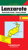 Lanzarotte Travel Map $9.95
 -
 Victoria Map Travel Map $9.95
 -

-

-
 Bolivia Map Travel Map $9.95

Namibia Travel Map

Hover over image to zoom
)
Product Description
Namibia Travel Map
Namibia at 1:1,000,000 from Freytag & Berndt with a separate booklet attached to the map cover also providing a street plan of central Windhoek. The map is double-sided with a very generous overlap between the sides. Caprivi Strip is shown as a separate inset at 1:1,200,000
Topography is shown by relief shading with spot heights plus graphics and/or colouring indicating sandy or rocky deserts, salt lakes or flats, wells and hot springs, etc. Many seasonal rivers and lakes are included. National parks and other protected areas are prominently highlighted.
Road network includes country tracks, with road numbers very clearly presented and distances shown on many smaller routes. Locations of petrol stations and border crossings are marked. Railway lines are included and local airports are marked. Also shown are internal administrative boundaries with names of the provinces.
Symbols highlight various places of interest including UNESCO World Heritage sites. The map has latitude and longitude lines at 1° intervals. Most place names are in larger print than found on other maps. Multilingual map legend includes English.
The index is in a separate booklet attached to the map cover and includes a street plan of central Windhoek. Also provided is a showing time zones within Africa and Europe.