Loading... Please wait...

Categories

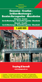
Macedonia Travel Map

Hover over image to zoom

  • Macedonia at 1:200,000 on a large map in Freytag & Berndt’s “Top 10 Tips” series with the index booklet also providing multilingual descriptions of the country’s 10 most interesting locations, plus a street plan of central Skopje. 

Names of towns and villages are in both Latin and Cyrillic alphabets; administrative regions, geographical features and places of interest are in the Latin alphabet only. 

Topography is presented by relief shading and spot heights, with names of mountain ranges, peaks, etc, plus colouring for woodlands. Road network includes local roads and selected cart tracks, indicates border crossings, and gives driving distances on most local roads. Scenic routes are highlighted. Railway lines are shown with stations. The map also shows the country’s internal administrative boundaries. 

Picturesque locations and other places of interest are highlighted and the map also indicates the country’s 10 best sights which are given multilingual descriptions in the booklet. Latitude and longitude lines are drawn at 10’ intervals. The index lists locations with their postcodes. The booklet also includes a street plan of central Skopje. 

Map legend and descriptions of the 10 best sights include English
Freytag
$11.95
SKU:
AK0717
Weight:
0.20 KGS

 Product Description

Freytag map of Macedonia scale 1:200,000, shows top 10 sights, index with postal codes, city map & distances in km.

Macedonia at 1:200,000 on a large map in Freytag & Berndt’s “Top 10 Tips” series with the index booklet also providing multilingual descriptions of the country’s 10 most interesting locations, plus a street plan of central Skopje. 

Names of towns and villages are in both Latin and Cyrillic alphabets; administrative regions, geographical features and places of interest are in the Latin alphabet only. 

Topography is presented by relief shading and spot heights, with names of mountain ranges, peaks, etc, plus colouring for woodlands. Road network includes local roads and selected cart tracks, indicates border crossings, and gives driving distances on most local roads. Scenic routes are highlighted. Railway lines are shown with stations. The map also shows the country’s internal administrative boundaries. 

Picturesque locations and other places of interest are highlighted and the map also indicates the country’s 10 best sights which are given multilingual descriptions in the booklet. Latitude and longitude lines are drawn at 10’ intervals. The index lists locations with their postcodes. The booklet also includes a street plan of central Skopje. 

Map legend and descriptions of the 10 best sights include English

 Find Similar Products by Category

You Recently Viewed...


newsletter

Copyright 2024 GoTrekkers. All Rights Reserved.
 Sitemap | Ecommerce Website Design by High Country Web Design.