 Loading... Please wait...
Currency Displayed in
- Home
- Canadian Hydrographic Nautical Charts/Maps
- Ontario, Manitoba & Great Lakes
- 6506 - Lake Manitoba / Lac Manitoba (Northern Portion / Partie nord)
Categories
Related Products

6506 - Lake Manitoba / Lac Manitoba (Northern Portion / Partie nord)
 Canadian Hydrographic Nautical Charts Marine Charts (CHS) Maps 6506")
Hover over image to zoom
, $20.00 (https://gotrekkers.com/lake-manitoba-lac-manitoba-northern-portion-partie-nord-chs-nautical-chart-chs-6506/))
Product Description
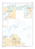
Lake Manitoba / Lac Manitoba (Northern Portion / Partie nord) CHS Nautical Chart CHS 6506
Scale: 1 : 100,000
Nautical Charts of Canada by the Canadian Hydrographic Service (CHS) for the navigation of Canadian waters & waterways. Whether it be commercial or for leisure these are the official charts by the CHS.
Click here to view a PDF version of our Ontario, Manitoba & Great Lakes index map. (large download)