 Loading... Please wait...
Currency Displayed in



- Home
- Travel Maps
- La Rochelle & Saintes Travel Reference Map
Categories
Related Products



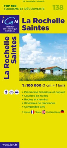
La Rochelle & Saintes Travel Reference Map
Hover over image to zoom


)
Product Description
The TOP100 Tourisme series is the ideal map for discovering a region and doing sightseeing on foot, by bike or by car thanks to its scale of 1:100,000 (1 cm = 1 km). This series combines the old Top 100 (1:100K) maps with the Département maps (1:100K)
A large amount of tourist information is represented very precisely in the cartography: parks and nature reserves, monuments, castles, museums, caves, viewpoints, refuges, climbing and white water sports sites, supervised beaches, etc.
- An enriched network of secondary roads, to allow bike rides in complete safety.
- For discovery on foot, the entire GR® and GR de Pays®
- For exploring by bike, the entire local road network and all of the Vélo-routes and Voies Vertes with the AF3V classification with tarmac or gravel roads, on their own site or shared with other vehicles
- For discovery by car, the entire road network: national, regional, departmental and secondary.
- Relief is represented by contour lines and dimensioned points
- An index of municipalities makes it easy to find your way around
Legend in three languages: French, English and German.