 Loading... Please wait...
Currency Displayed in
- Home
- Maps By Sport
- Ski Tour Maps
- Kokanee Glacier Provincial Park Ski Routes
Categories
Kokanee Glacier Provincial Park Ski Routes
Product Description
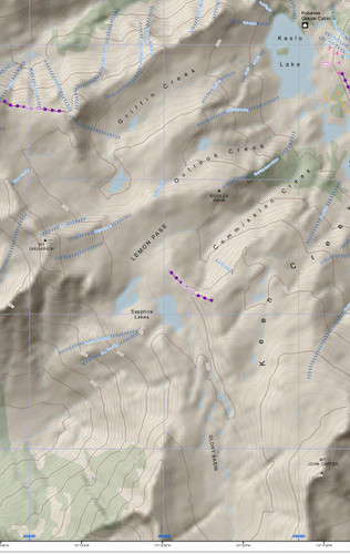
Map of Ski Tour area within Kokanee Glacier Provincial Park winter recreation map, British Columbia. scale 1:10,000 approx. and covers a 10 x 8 km area.
Kokanee Glacier Park winter recreation map from 2009. 2009 Ski Routes are shown for Kokanee Provincial Park produced by BC govt in 2009 & is now out of print. Size 32" x 24", scale was 1:10,000 but will be off due to the resizing of the image. The map does have lat/long & utm grid on it. Map is centered on the Kokanee Glacier Cabin & the Slocan Chief Cabin.
The map is printed on paper and comes folded in a protective plastic sleeve.


