 Loading... Please wait...
Currency Displayed in
- Home
- Travel Maps
- Italy Travel Map
Categories
Related Products
-
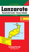 Lanzarotte Travel Map $9.95
 -
 Victoria Map Travel Map $9.95
 -

-

-
 Bolivia Map Travel Map $9.95

Italy Travel Map

Hover over image to zoom
)
Product Description
Freytag double-sided, folded road map of Italy at 1:600,000 with 12 city map, car ferries & index with postal codes. Great quality travel map to buy for your travels through Italy.
Freytag & Berndt’s large, double-sided road map of Italy at 1:600,000, with a separate booklet attached to the map cover providing street plans of the country’s 12 main cities plus an extensive index listing all localities with their postcodes.
Bold relief shading with plenty of names of geographical features provides a good presentation of the country’s topography, both in the northern part where the coverage extends to include most of southern Switzerland and the Austrian Alps south of Innsbruck, and along the spine of the Apennines.
Road network includes many small local roads, most with driving distances. Gradients are marked on steep roads. The railway network and ferry connections are included. Symbols highlight some places of interest, including national parks, but the map is basically designed to show the road network rather than the country’s great artistic and historical heritage.
The map has latitude and longitude lines at intervals of 30’. Multilingual map legend includes English.
A separate booklet attached to the map cover contains an index, listing all localities with their postcodes and providing street plans of Ancona, Bari, Cagliari, Bolzano, Florence, Genoa, Milan, Naples, Palermo, Rome, Turin and Venice.