 Loading... Please wait...
Currency Displayed in
- Home
- Travel Maps
- Greece Travel Map
Categories
Related Products
-
 Victoria Map Travel Map $9.95
 -

-

-
 Bolivia Map Travel Map $9.95
 -
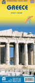 Greece itmb Travel Map $9.95

Greece Travel Map
 and multilingual cultural guide to the country’s history and its heritage. Modern Greek names are used for the archaeological sites, e.g. Mikines for Mycenae, etc.)")
Hover over image to zoom
)
Product Description
Freytag double-sided, folded road map of Greece at 1:500,000 with attached culture guide booklet outlining all important general and tourist information on Greece, car ferries, index with postal codes and colour photos. Great quality travel map to buy for your trip to Greece.
Double-sided road map of Greece at 1:500,000 from Freytag & Berndt with a separate index booklet which also includes a 16-page English language cultural guide with tourist information and brief descriptions of numerous archaeological, historical and other sites.
Bold relief shading with names of mountain ranges and main peaks shows the country’s topography. All place names are given in both Greek and Latin alphabets. Road network includes small local roads but without distinguishing between surfaced and gravel roads. Toll roads and motorway services are shown, with diving distances marked on many secondary routes. The map also shows railway network and ferry routes.
National parks and protected areas are highlighted and symbols show various places of interest including archaeological and historical sites, marinas, campsites, etc. Latitude and longitude lines are drawn at intervals of 30’. Multilingual map legend includes English.
A separate 66-page booklet attached to the map cover includes an index (with postcodes) and multilingual cultural guide to the country’s history and its heritage. Modern Greek names are used for the archaeological sites, e.g. Mikines for Mycenae, etc.)