 Loading... Please wait...
Currency Displayed in
- Home
- Historical Maps
- France battlefields Map
Categories
France battlefields Map
Product Description
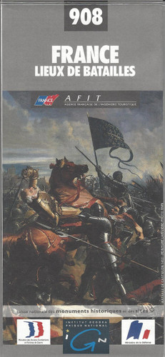
France Battlefields Map. By IGN of France.
IGN’s excellent World War I commemorative map presented in an encapsulated, waterproof wall map format, size 121 x 100cm (46.5" x 39.5" approx). The map provides an overview of the Western Front supported by three more detailed enlargements of the main battlefields including the Somme area, and highlights 15 special Remembrance Trails, remaining trenches, numerous memorial sites, museums, cemeteries, etc.
Prepared by the IGN in collaboration with the Mission du Centenaire programme set up by the French Government, the map has a far more detailed base for presenting all the WWI-related information than found on other maps of the Western Front. A road map of northern France at 1:410,000 shows the whole of the front line in October 1914 from the Swiss border to the coast of Flanders, also indicating the limit of the German advance and the eventual Armistice line of 11.11.1918. Three panels provide more detailed enlargements at 1:290,000: the Béthune - Péronne area including the Somme battlefields, Arras and Vimy Ridge; the Reims - Compiègne area with Chemin des Dammes; plus Verdun.
Both the main map and the enlargements indicate numerous memorial locations, including several commemorative tours by car, train, bicycle or walking, e.g. The Front route between Ypres and the Somme, a 92-km Albert - Thiepval - Péronne route through the main Somme battlefields, The British Circuit of Remembrance and The Victoria Cross routes near Soissons, etc. 15 tours have brief descriptions with website addresses and some with QR codes for downloading further information. Also provided is a year-by-year list of the principal Western Front battles with each entry cross-referenced to its location on the main map.
Although the map covers the whole of the Western Front, including Flanders with Ypres and Passendale/ Passchendaele, the overprint within Belgium is more limited – the map is designed to provide information mainly within France.


