 Loading... Please wait...
Currency Displayed in
- Home
- Maps By Sport
- Hiking Maps
- Cinque Terre Portofino Trekking Map
Categories
Related Products
-
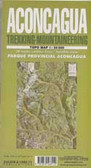 Aconcagua Trekking map $9.95
 -
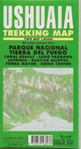 Ushuaia Trekking Map $9.95
 -
 Pucon Trekking Map $9.95
 -

-


Cinque Terre Portofino Trekking Map

Hover over image to zoom
)
Product Description
Cinque Terre on a GPS compatible hiking map from Freytag & Berndt, with long-distance routes and local waymarked paths, cycling routes, campsites, places of interest, etc. The maps includes the Portofino peninsula, as shown on the area coverage image.
The base map has contours at 50m intervals, supplemented by relief shading. National parks and protected areas are clearly marked. An overprint highlights local hiking routes, indicating their numbers and waymarking. Also shown are local sections of long-distance routes and special circuits: Alta Via del Monti Liguri, Alta Via del Golfo, Alta Via delle Cinque Terre, Sentiero Verdeazurro and Trekking Lunigiana.
The map also shows local bridleways and mountain bike routes. A wide range of symbols indicate various facilities and places of interest, including campsites, sport and recreational sites, museums and interesting churches, etc. Railway stations are clearly marked, as are coastal ferry connections.
The map has a 2-km UTM grid. Map legend includes English. A separate multilingual booklet has 11 pages of text in English with a general introduction to the area, plus descriptions of main interesting locations and a selection of hiking recommendations.