Loading... Please wait...

Categories

Chad Travel Map

Hover over image to zoom

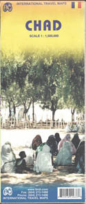
  • Chad on a double-sided, indexed map with a street plan of central N’djamena. The map has altitude colouring but with no spot heights and relatively few names of geographical features. River network is presented in more detail and with more names, including seasonal streams and swamps. National parks are prominently marked. Road network includes unpaved roads and tracks, with intermediate distances on most routes.

Symbols mark locations with tourist accommodation, local airfields, medical facilities, post offices, places of interest, etc. The map is indexed and has a latitude and longitude grid at intervals of 1º.

Also includes is a street plan showing main streets and various official buildings in N’djamena. Coverage extends east into Sudan to include Western Darfur around El Geneina, Lingei and Hagar Banga, showing main routes across the region.
ITMB
$9.95
SKU:
IT1635
Weight:
0.20 KGS

 Product Description

Chad on a double-sided, indexed map with a street plan of central N’djamena. The map has altitude colouring but with no spot heights and relatively few names of geographical features. River network is presented in more detail and with more names, including seasonal streams and swamps. National parks are prominently marked. Road network includes unpaved roads and tracks, with intermediate distances on most routes.

Symbols mark locations with tourist accommodation, local airfields, medical facilities, post offices, places of interest, etc. The map is indexed and has a latitude and longitude grid at intervals of 1º.

Also includes is a street plan showing main streets and various official buildings in N’djamena. Coverage extends east into Sudan to include Western Darfur around El Geneina, Lingei and Hagar Banga, showing main routes across the region.

 Find Similar Products by Category

You Recently Viewed...


newsletter

Copyright 2024 GoTrekkers. All Rights Reserved.
 Sitemap | Ecommerce Website Design by High Country Web Design.