 Loading... Please wait...
Currency Displayed in
- Home
- Travel Maps
- Cape Verde Islands Travel Map
Categories
Related Products
-
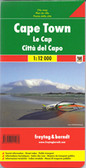 Cape Town Travel Map $9.95
 -
-
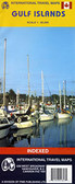 Gulf Islands Travel Map $7.95
 -
-


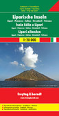
Cape Verde Islands Travel Map
.
Maps of groups at 1:150,000:
Boavista and Sal; Santo Antão, Sao Vicente, Santa Luzia, Ilheu Braco, Ilheu Razo, and São Nicolau; Santiago and Maio; Fogo and Brava.")
Hover over image to zoom
)
Product Description
Cape Verde Islands on a large double-sided map from Freytag & Berndt, with the larger islands shown both individually and in groups with the surrounding islands, all presented at a convenient scales and with tourist information.
Relief shading and spot heights indicate the topography, with roads clearly marked and icons highlighting main ports, ferries, archaeological sights and other places of interest. A general map of the whole Cape Verde archipelago shows frequency of ferry connections between various islands. Latitude and longitude lines are shown on all island maps. Multilingual map legend includes English.
Larger islands at 1:80,000
Fogo; Santiago; Santo Antão; Sao Nicolau; São Vicente; Brava (at 1;30,000).
Maps of groups at 1:150,000:
Boavista and Sal; Santo Antão, Sao Vicente, Santa Luzia, Ilheu Braco, Ilheu Razo, and São Nicolau; Santiago and Maio; Fogo and Brava.