Loading... Please wait...
Currency Displayed in
- Home
- Canoe Maps Canada
Categories
Canoe Maps Canada
Canoe Maps Canada
Welcome to GoTrekker Maps. Canoe Maps Canada has merged with GoTrekker Maps to offer more maps and better services. GoTrekker Maps is partnered with Churchill River Canoe Outfitters.

GoTrekker Maps has created over 600 specialty maps with a focus on canoeing, hiking, and National/ Provincial Park maps from across Canada.
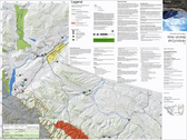
These specialty maps feature in-depth topographically accurate maps of Canada's most pristine destinations. They include many features not found on standard topographic maps.
Canoeing Maps
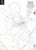
The majority of the maps which GoTrekkers has created are canoeing focused. These maps include detailed canoe routes, information about portages, recommended camping locations, and locations of points of interest (rock paintings, etc.). Many of the maps are located in Northern Saskatchewan but also include; southern Saskatchewan, southern Alberta, British Columbia, Manitoba, and the three Northern Canadian Territories (Northwest Territories, Nunavut, and Yukon).
Hiking Maps
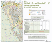
GoTrekkers offers a number of Hiking maps including the Boreal Trail in Meadow Lake Provincial Park, Grasslands National Park, Juan de Fuca Trail in BC, and the West Coast Trail on Vancouver island.
Canada's Northern National Parks
We have produced the only map series to cover Canada's Northern National Parks.
These include: Banff & Area, Banff Canmore, Jasper & Area, Jasper Maligne Lake, Lake Louise & Area, Lake Louise North, Lake O'Hara Area National Park, Waterton National Park, Wood Buffalo National Park, Ya Ha Tinda / Lake Louise North, Aulavik National Park, Nahanni National Park Reserve, Tuktut Nogait National Park, Qausuittuq National Park, Wood Buffalo National Park, Auyuittuq National Park, Quttinirpaaq National Park, Sirmilik National Park, Ukkusiksalik National Park, Grasslands National Park, Prince Albert National Park, Ivvavik National Park, Kluane National Park, Vuntut National Park & Wapusk National Park.
Fireboxes, Tents, and Tarps
Churchill River Canoe Outfitters began to recognize a need for much more superior and functional essentials - tents, shelters, tarps, and fireboxes to help make wilderness excursions more comfortable and pleasurable. There is nothing worse than being miles from civilization with malfunctioning equipment. GoTrekker Maps continues with that belief and now sells The Environmental Firebox - a three sided metal box with a grate and false bottom to contain a fire without leaving a fire scar on the earth. The Firebox cooks food twice as fast and with half the wood as a regular fire.
For information on our tarps and Campfire Tents, please contact ric.crco@sasktel.net