 Loading... Please wait...
Currency Displayed in
- Home
- Maps By Sport
- Hiking Maps
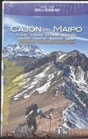
- Cajon del Maipo Chile Trekking Map
Categories
Cajon del Maipo Chile Trekking Map
Product Description
Professional Map of the upper Maipo valley southeast of Santiago, developed by the Institute for Cartography at the Dresden Technical University in cooperation with the German Andes Club.
Overview map 1:100,000 showing the whole Cajón del Maipo with its sidevalleys El Yeso and El Volcán.
Detail map 1:50,000 showing the High Andes section with Nature Preserve El Morado, Cerro Marmolejo (6108 m), San José volcano (5856 m) and lots more of trekking and climbing routes.
GPS compatible, with level curves every 50 m, with mountain huts, thermal baths, lodgings, campsites, touristic services. Landscape pictures and drawings of the local fauna. Trekkingchile, 2012
Trekkingchile, 1st. edition 2012
Travel & Trekking Map, Central Chile, scale 1:100,000 / 1:50,000
English - German - Spanish


