Loading... Please wait...

Categories

Burkina Faso and Niger Travel Map

Hover over image to zoom

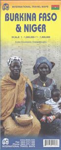
  • Burkina Faso and Niger on a double-sided, indexed map from ITMB, presenting each country separately at 1:1,000,000 1:1,950,000 respectively and accompanied by street plans of Ouagadougou, Bobo-Dioulasso and Niamey. Altitude colouring shows the topography (with bands in feet in Burkina Faso and in metres in Niger). In Burkina Faso the map indicates areas of periodic inundation, whilst in Niger numerous water wells, salt pans, sand dunes and lava fields are also marked. In both countries parks and nature reserves are highlighted. 

Road network indicates seasonal roads and shows locations of fuel supplies and border crossings, plus distances on main routes. Airports and aerodromes for small craft are marked; towns are annotated with symbols indicating what facilities can be found there. Each map has latitude and longitude lines (at 1° in Burkina Faso and 2° in Niger), plus a separate index. 

Street plans, annotated with names of hotels, various tourist facilities and main buildings cover Ouagadougou (with an enlargement for the town cente), Bobo-Dioulasso and Niamey.

ITMB
$9.95
SKU:
IT1567
Weight:
0.20 KGS

 Product Description

ITMB map of Burkina Faso & Niger scale 1;1,000,000 & 1:950,000

Burkina Faso and Niger on a double-sided, indexed map from ITMB, presenting each country separately at 1:1,000,000 1:1,950,000 respectively and accompanied by street plans of Ouagadougou, Bobo-Dioulasso and Niamey. Altitude colouring shows the topography (with bands in feet in Burkina Faso and in metres in Niger). In Burkina Faso the map indicates areas of periodic inundation, whilst in Niger numerous water wells, salt pans, sand dunes and lava fields are also marked. In both countries parks and nature reserves are highlighted. 

Road network indicates seasonal roads and shows locations of fuel supplies and border crossings, plus distances on main routes. Airports and aerodromes for small craft are marked; towns are annotated with symbols indicating what facilities can be found there. Each map has latitude and longitude lines (at 1° in Burkina Faso and 2° in Niger), plus a separate index. 

Street plans, annotated with names of hotels, various tourist facilities and main buildings cover Ouagadougou (with an enlargement for the town cente), Bobo-Dioulasso and Niamey.

 Find Similar Products by Category

You Recently Viewed...


newsletter

Copyright 2024 GoTrekkers. All Rights Reserved.
 Sitemap | Ecommerce Website Design by High Country Web Design.