 Loading... Please wait...
Currency Displayed in
- Home
- Travel Maps
- Botswana Travel Map
Categories
Related Products
-
 Victoria Map Travel Map $9.95
 -

-

-
-
 Bolivia Map Travel Map $9.95

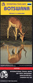
Botswana Travel Map

Hover over image to zoom
)
Product Description
Botswana at 1:1,100,000 on an indexed map from Freytag & Berndt prominently highlighting the country’s national parks, game reserves and topographic features such as salt lakes, plus a street plan of central Gaborone.
The map has a plan base with some relief shading in the more hilly parts of the country. Salt lakes and marshes are marked, as well as seasonal rivers and lakes. National parks and game reserves are clearly highlighted.
Road network indicates cart tracks and shows distances on main routes and locations of petrol stations. Border crossing points show their opening times. Railway lines are included; local airports are marked; and veterinary cordon fences and locations of quarantine camps are prominently shown. The map also indicates internal administrative boundaries and names of the provinces.
Icons highlight locations of tourist lodges and camp sites, many annotated with their names. Also marked are places of interest such as UNESCO World Heritage sites, caves, hot springs, archaeological sites, etc. Latitude and longitude lines are drawn at 1° intervals. The index is next to the map. Map legend includes English
Also provided is a street plan of central Gaborone, showing locations of some of the governmental offices, embassies etc.