Loading... Please wait...

Categories

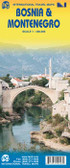
Bosnia Hercegovina Travel Map

Hover over image to zoom

  • Bosnia-Herzegovina on a large, double-sided, indexed road map at 1:200,000 from Freytag & Berndt, showing the whole country at 1:200,000, with an index booklet attached to the cover providing street plans of central Sarajevo and Banja Luka, plus descriptions of 15 best sights prominently highlighted on the map. Within the Republika Srpska administrative area names of selected locations are also shown in the Cyrillic alphabet. 

The map is double-sided with a generous overlap and Sarajevo included on both sides; the border area east of Tuzla is shown on an inset. The southern side of the map also includes Croatian coast between Split and Dubrovnik. Topography of this mountainous country is vividly presented by relief shading with spot heights and names of mountain ranges, valleys, peaks, etc. Road network includes selected country tracks, with driving distances shown on many local roads, traffic restriction and seasonal closures, assistance points of automobile associations, border crossings, etc. Scenic routes are highlighted. Symbols indicate various places of interest and facilities including campsites, museums, etc. Interesting locations are prominently highlighted, with 15 best sights cross-referenced to their descriptions in the index booklet. Latitude and longitude lines are drawn at 10’ intervals. Map legend and the text include English.
Freytag
$11.95
SKU:
AK0709
Weight:
0.20 KGS

 Product Description

Freytag double-sided, folded road and leisure map of Bosnia & Herzegovina at 1:250,000 with tourist information, car ferries & distances in km. Great map to buy for your travels through Bosnia and Herzegovina.

Bosnia-Herzegovina on a large, double-sided, indexed road map at 1:200,000 from Freytag & Berndt, showing the whole country at 1:200,000, with an index booklet attached to the cover providing street plans of central Sarajevo and Banja Luka, plus descriptions of 15 best sights prominently highlighted on the map. Within the Republika Srpska administrative area names of selected locations are also shown in the Cyrillic alphabet. 

The map is double-sided with a generous overlap and Sarajevo included on both sides; the border area east of Tuzla is shown on an inset. The southern side of the map also includes Croatian coast between Split and Dubrovnik. Topography of this mountainous country is vividly presented by relief shading with spot heights and names of mountain ranges, valleys, peaks, etc. Road network includes selected country tracks, with driving distances shown on many local roads, traffic restriction and seasonal closures, assistance points of automobile associations, border crossings, etc. Scenic routes are highlighted. Symbols indicate various places of interest and facilities including campsites, museums, etc. Interesting locations are prominently highlighted, with 15 best sights cross-referenced to their descriptions in the index booklet. Latitude and longitude lines are drawn at 10’ intervals. Map legend and the text include English.

 Find Similar Products by Category

You Recently Viewed...


newsletter

Copyright 2024 GoTrekkers. All Rights Reserved.
 Sitemap | Ecommerce Website Design by High Country Web Design.