 Loading... Please wait...
Currency Displayed in
- Home
- Maps By Sport
- Hiking Maps
- Alrededor De Santiago Chile Trekking Map
Categories
Alrededor De Santiago Chile Trekking Map
Product Description
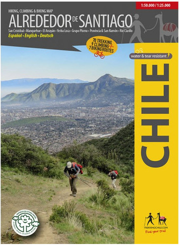
NEW EDITION 2018: The first map showing 70 hiking, 9 climbing and 7 biking routes in the immediate vicinity of Santiago de Chile, including the following areas:
- Cerro San Cristóbal
- Cordón Manquehue
- El Arrayán - Pochoco
- La Dehesa
- Santuario Yerba Loca, with Cerro La Paloma (4910 m)
- Grupo Plomo: Cerro Pintor (4180 m), Cerro Leonera (4954 m), Punta Santiago (5083 m), Cerro Plomo (5424 m), Cerro Klatt (4309 m)
- Valle Olivares
- Alto del Naranjo - Cerro Ñipa - Cerro Provincia (2751 m)
- San Carlos de Apoquindo
- Parque Aguas de Ramón
- Parque Mahuida and Cantalao
- Parque Quebrada de Macul, Cerro La Cruz, Cerro San Ramón (3253 m), Punta Damas (3149)
- Parque Panul
- El Manzano - Los Azules - La Ermita
- Cajón Río Colorado - Alfalfal - Ruta del Cóndor
- Parque Nacional Río Clarillo
Scale 1:50.000, with two detailed maps 1:25.000 for Río Clarillo and Cerro San Cristobal.
With routes (distance and time), accesses, contour lines every 50 m, GPS-compatible network, accommodations, huts, campsites, etc... Photos of the attractions and drawings of the local fauna.
Trekkingchile, 1st edition 2018
Trekking, climbing and cycling map, Central Chile, scale 1:50.000 / 1:25.000
Printed on stone paper, ecological, tear- and waterproof.
Spanish - English - German.


