 Loading... Please wait...
Currency Displayed in
- Home
- Maps By Sport
- Canoe Maps Canada
- Algonquin Barron Achray Map
Categories
Related Products

Algonquin Barron Achray Map

Hover over image to zoom
)
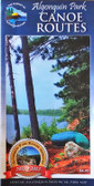
Product Description
The dominant feature of this popular paddling, hiking and camping area on the east side of Algonquin Park is the 100-metre deep Barron Canyon, which you can enjoy from above at a great hiking viewpoint, or from below while paddling the River.
But there are other great attractions in this compact, feature-rich area, including High Falls, Brigham Chutes, the Barron River, old log drive relics and much more, all detailed on our large-scale 1:40,000 map.
The back side offers colour photos and textual descriptions about local flora and fauna, suggested routes, safety concerns and contact info. Also covers the Sec/Mallard Lakes area.
As usual, this 1:40,000 scale map provides extraordinary terrain and vegetation detail, this map features campsites, portages, access points, hiking trails, facilities like campgrounds, telephones, historic sites, rental ranger cabins, and many more attractions. And, like others in the series, it's updated regularly and is waterproof.