 Loading... Please wait...
Currency Displayed in
- Home
- Travel Maps
- Algarve Travel Map
Categories
Related Products
-
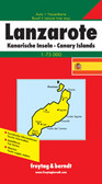 Lanzarotte Travel Map $9.95
 -
 Victoria Map Travel Map $9.95
 -

-

-
 Bolivia Map Travel Map $9.95

Algarve Travel Map

Hover over image to zoom
)
Product Description
Freytag double-sided, folded road map of Algarve and Costa del Sol at 1:420,000 with tourist information, index with postal codes & distances in km. Map also includes city map insets for Granada (8"x6"), Sevilla (8"x6"), Malaga (8"x6"), Albufeira (8"x6"), Faro (5"x6"), Portimao (5"x9"), Gibraltar (5"x9"), Marbella (8"x4") and Vilamoura (8"x4"). Best quality travel map that you can buy for your vacation trip to Algrave and Costa del Sol, Spain.
This detailed map covers the Algarve and some of the adjacent region to include the area around Odemira. The various classes of road are distinguished, from dual carriageways to local secondary roads, and railways are also shown. Scenic routes are highlighted and road distances between selected points are indicated. Essential geographic features are shown eg. rivers, lakes, forests and nature reserves and an indication of topography is given by relief shading. Numerous symbols are used to denote places of interest, and 7 inset maps show street plans of Lagos, Portimão, Praia da Rocha, Albufeira, Vilamoura, Faro and Tavira.