 Loading... Please wait...
Currency Displayed in
- Home
- Maps By Sport
- Canoe Maps Canada
- Yukon River map set from Carcross to Dawson City
Categories
Related Products
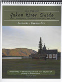


Yukon River map set from Carcross to Dawson City

Hover over image to zoom
)
Product Description
Yukon River Map Set of eight maps from Carcross to Dawson City. Scale: 1:100,000
Yukon River 1 – Carcross to Whitehorse, 17"x40"
Yukon River 2 – Whitehorse to Lower Lake Laberge, 10"x41"
Yukon River 3 – Lower Lake Laberge to Big Salmon River, 10"x41"
Yukon River 4 – Big Salmon River to Carmacks, 41"x10"
Yukon River 5 – Carmacks to Fort Selkirk, 42"x10"
Yukon River 6 - Fort Selkirk to Coffee Creek, 41"x10"
Yukon River 7 - Coffee Creek to Stewart River, 10"x31"
Yukon River 8 - Stewart River to Dawson City, 10"x41"
Includes: Campsites, points of interest, campgrounds with their contact information, rapid information.
Printed on paper the maps come folded in protective plastic sleeves.