 Loading... Please wait...
Currency Displayed in
Categories
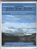
Yukon River Guidebook - Whitehorse to Carmacks - Guide + Waypoints Download
Product Description
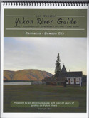
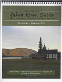
Whitehorse to Carmacks. All the Yukon River guidebooks have been researched and prepared by Len Webster, an adventure river guide who has led countless tours over the 24 years that he worked in the Yukon. His knowledge of the rivers, their histories, what is important to be aware of, and how best to prepare, will enhance and compliment your paddling experience. Yukon Rivers guidebooks are not an instructional manual on how to paddle a canoe or kayak. Our goal is to provided paddlers with information that will help with preparation, reliable campsites, and safety. It also provides historical, cultural, and natural background to better appreciate the river. Topics covered include: » Whitehorse and Dawson City Info, » detailed river paddling notes, » clothing and gear, » waterproofing, » bear safety, » fishing, » preserving the wilderness, » wildlife along the river, » favourite river readings, » complete list of resources We have condensed the many topographic maps you would need to paddle the rivers into a concise easy to follow, accurate, and clear format. They feature: Top-situated spiral binding that allows for easy flipping between numbered pages. Canadian topographic maps – detailed, accurate, and in full colour. 8.5×11 inch glossy pages that fit conveniently into waterproof map cases or large Ziplock bags. Scaled between 1:50 000 & 1:70 000 Three dimensional shading that displays mountains, valleys, and steep river banks. Cautionary warnings with prescribed options. Easy to read and follow historical notes on the map pages. Relevant, interesting information and side stories on the map pages. Location of high water campsites. Lead guide’s choices for best campsites Rating of campsites by scenery and amenities. Global Positioning System (GPS) coordinates. Distances between GPS coordinates in kilometers and miles.
This is the downloadable pdf version of this guidebook.
Includes waypoints in a gpx fomat

