 Loading... Please wait...
Currency Displayed in
- Home
- Canadian Hydrographic Nautical Charts/Maps
- Arctic
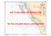
- 7067 - Spicer Islands to West Entrance of/ à L'Entrée Ouest de Fury and/et Hecla Strait
Categories
Related Products
-
-
-
-
-
 7487 - Fury and Hecla Strait $20.00

7067 - Spicer Islands to West Entrance of/ à L'Entrée Ouest de Fury and/et Hecla Strait
 Maps 7067")
Hover over image to zoom
)
Product Description
Spicer Islands to West Entrance of/ à L'Entrée Ouest de Fury and/et Hecla Strait CHS Nautical Chart CHS 7067
Scale: 1 : 500,000
Nautical Charts of Canada by the Canadian Hydrographic Service (CHS) for the navigation of Canadian waters & waterways. Whether it be commercial or for leisure these are the official charts by the CHS.
Click here to view a PDF version of our Arctic index map. (large download)