 Loading... Please wait...
Currency Displayed in
- Home
- Maps By Sport
- Hiking Maps
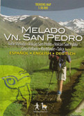
- San Pedro de Atacama Chile Trekking Map
Categories
San Pedro de Atacama Chile Trekking Map
Product Description
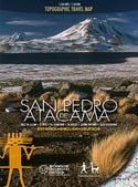
Completely updated travel and trekking map of the Atacama region around San Pedro,
between Calama and Paso Sico, in Northern Chile; reaches about 25 miles into Bolivian territory. With trekking routes, altitude levels each 100 m, GPS compatible.
Hiking & Biking Map 1:50,000 of San Pedro's immediate surroundings. Landscape pictures and drawings of the Andean fauna.
City Map of San Pedro. Developed by the Institute for Cartography at the Dresden Technical University.
Trekkingchile, 7th edition 2015
Travel & Trekking Map, Northern Chile, scale 1:350,000 / 1:50,000
Printed on ecologic, water & tear resistant Stone Paper.
English – German - Spanish.

