 Loading... Please wait...
Currency Displayed in
- Home
- Maps By Sport
- Hiking Maps
- Patagonian South Icefield Map
Categories
Patagonian South Icefield Map
Product Description
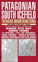
FITZ ROY TREKKING MAP Highly improved 2015 edition!
The best ever trekking map of this popular area. 50 meter contour lines, timed trails, shelters, camping and inns. Realistic relief based in satelital imagery. Los Glaciares National Park, Monte Fitz Roy, Cerro Torre, Cerro Huemul, Lago del Desierto, Lago O'Higgins, Lago Viedma, Icefield, etc.
El mejor mapa de trekking existente de esta popular zona. Curvas de nivel cada 50 metros, circuitos con tiempo de marcha, refugios, camping y hosterias. Relieve realista basado en imagenes satelitales. Parque Nacional Los Glaciares, Monte Fitz Roy, Cerro Torre, Cerro Huemul, Lago del Desierto, Lago O'Higgins, Lago Viedma, Hielo Continental Sur, etc.
Also
MONTE FITZ ROY 65 x 95 cm US$ 9.95 (Including the traditional trekking area and Lago del Desierto)
MINIMAP 65 x 47 cm US$ 5.95 (Containing only the traditional trekking area)


