 Loading... Please wait...
Currency Displayed in
- Home
- Maps By Sport
- Canoe Maps Canada
- Oldman River Map Set - Oldman River Campground to Grand Forks/South Saskatchewan River - SYNTHETIC
Categories
Related Products


Oldman River Map Set - Oldman River Campground to Grand Forks/South Saskatchewan River - SYNTHETIC

Hover over image to zoom
)
Product Description
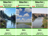
Oldman River Map Set of three maps from Oldman River Campground to Grand Forks/South Saskatchewan River
Includes:
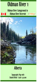
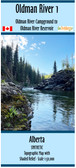
Oldman River 1 - Oldman River Campground to Oldman River Reservoir (1:50,000 + Contours 25/100 intervals, dimensions: 10x44 inches)
Oldman River 2 - Oldman River Reservoir to Lethbridge (1:100,000 + Contours 10/50 intervals, dimensions: 15x41 inches)
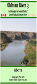
Oldman River 3 - Lethbridge to Grand Forks/ South Saskatchewan River (1:100,000 + Contours 10/50 intervals, dimensions: 10x41 inches)
The maps show campgrounds, river access points with coordinates in UTM and decimal degrees, major rapids, the dam, weirs, and portages.
This map set is printed on synthetic/waterproof paper and comes folded in a protective plastic sleeves.