 Loading... Please wait...
Currency Displayed in
- Home
- NRCAN Topographic Maps (Canada)
- Northwest Territories Topographic Map
Categories
Northwest Territories Topographic Map
Product Description
DETAILED CANADIAN & NORTHWEST TERRITORIES TOPOGRAPHIC INDEX MAP:
If the Canadian topographic index map provided below is not detailed enough for you to find the map you wish to purchase, please Click here to view our extremely detailed Canadian topographic index map. This will open up a new webpage where you can identify the map you wish and will be able to return to this page and add the particular map(s) to your shopping cart.
Northwest Territories Topographic Maps Canada
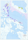
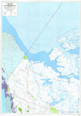
Please use the Northwest Territories topographic index map above to help you find the map you need. You may zoom in to move around to find the codes to identify the topographic map you are looking for. If you wish to buy a 1:250,000k map please enter in the Grid Number and the Grid Letter only. If you wish a more detailed map please enter an additional number from 1-16 for the 1:250,000k scale.
Click here to view a PDF version of our Yukon topographic index map.
Canadian Map Index System
Click here for information on the Canadian map index system.
- All Canadian topographic maps are printed on paper or synthetic material, folded & inserted into a vinyl sleeve. As an option the maps can be sent rolled flat before they are folded on paper or synthetic material. Shipping is extra & quoted individually for this.
- The map areas located in a mountainous terrain can have 3D shaded relief added to give a more realistic view. Checkout the samples page.
- Size of folded map is 130mm x 250mm.
- Be advised most maps are colour, some are black & white, some are metric, some are imperial, depending on when the map was issued.
- Custom topographic maps for hiking etc can be made, please contact us to make arrangements.
- *** NEW *** This is a new Canada index from the govt which hopefully will not be moved, it is a really good index.
- *** NEW *** This is a new Canada index from the govt which hopefully will not be moved, it is a really good index. http://ftp.geogratis.gc.ca/pub/nrcan_rncan/vector/index/html/geospatial_product_index_en.html


