 Loading... Please wait...
Currency Displayed in
- Home
- Maps By Sport
- Hiking Maps
- Nevados de Chillian Chile Trekking Map
Categories
Nevados de Chillian Chile Trekking Map
Product Description
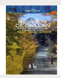
Hiking map of the beautiful mountain area around Termas de Chillán and the Ñuble Preserve. With level curves each 50 m, hiking routes, thermal springs, mountain huts and campsites. GPS compatible. Completely revised and updated, includes landscape pictures and drawings of the local fauna. Local map of Las Trancas, with lodgings and tourist services.
Trekkingchile, 2nd edition 2012
Travel & Trekking map, Central Chile, 1:50,000
English – German - Spanish.

