 Loading... Please wait...
Currency Displayed in
- Home
- Maps By Sport
- Hiking Maps
- Gros Morne National Park
Categories
Related Products
-
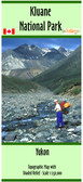 Kluane National Park map $22.00
 -
-
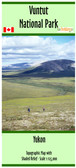 Vuntut National Park map $22.00
 -
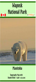 Wapusk National Park map $22.00
 -
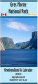

Gros Morne National Park

Hover over image to zoom
)
Product Description
The Gros Morne National Park map has a scale of 1:85,000 with shaded relief.
It features the 18 official hiking trails along with the backcountry hiking routes, the three groomed ski trails and backcountry routes, campgrounds, backcountry campsites, ski huts, points of interest within and surrounding the park
The map features trailhead locations in both decimal degrees and UTM coordinates.
The map dimensions are 27x41.5 inches.
Printed on paper, the map comes folded in a protective plastic sleeve.