 Loading... Please wait...
Currency Displayed in
- Home
- Travel Maps
- Europe Pilgrim Paths Travel Map
Categories
Europe Pilgrim Paths Travel Map
Product Description
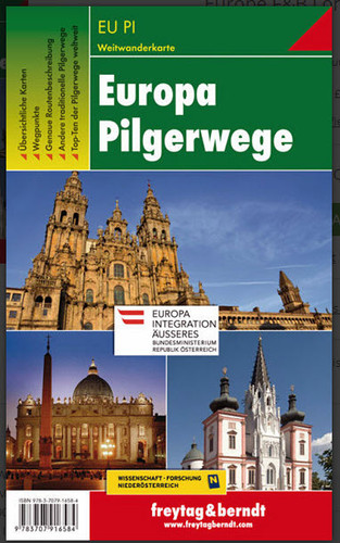
Europe’s three main pilgrimage routes: the Way of St. James to Santiago de Compostela, routes to Rome, and Virgin Mary trails in Central Europe, presented on an overview map at 1:3,500,000, with on the reverse Central Europe with Italy and most of France shown in greater detail at 1:2,000,000.
On one side the main map at 1:3,500,000 includes southern Scandinavia and extends to Moscow and the Crimea. The base map has a very effective relief shading to indicate mountain ranges and shows the network of main and selected secondary roads. Colour overprint highlights the network of three principal pilgrimage themes: the Way of St. James towards Santiago de Compostela, trails to Rome including the Via Francigena from Canterbury, and routes associated with the Virgin Mary within Central Europe. For each theme the overprint indicates the main route and its secondary variants, with section numbers cross-referenced to the accompanying booklet.
On the reverse an enlargement at 1:2,000,000 presents the main part of the Continent in greater detail and clarity, extending from southern Sweden and Denmark to Sicily, and from London and Barcelona to Poland’s eastern border and Belgrade. Map legend is in German and English.
Accompanying 54-page booklet, available in German only, lists the routes divided into sections and grouped into continental zones, e.g. the Way of St. James in Central Europe, in Eastern Europe, etc, The booklet also provides brief descriptions of other trans-European trails not marked on the map, plus gives contact addresses for various related organizations.


