Loading... Please wait...

Categories

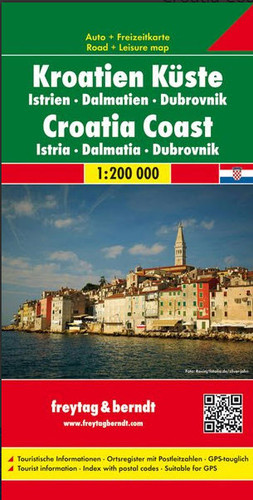
Croatia Coast Travel Map

Hover over image to zoom

  • One of two large, double-sided detailed road maps, with very clear cartography, subtle relief shading and spot heights indicating the terrain. Road information includes scenic routes, toll roads, traffic restrictions and seasonal closures, etc. Places of interest are highlighted and the maps also show ferry connections on the Dalmatian coast. A grid in steps of 15' shows latitude and longitude. Map legend includes English.
  • One of two large, double-sided detailed road maps, with very clear cartography, subtle relief shading and spot heights indicating the terrain. Road information includes scenic routes, toll roads, traffic restrictions and seasonal closures, etc. Places of interest are highlighted and the maps also show ferry connections on the Dalmatian coast. A grid in steps of 15' shows latitude and longitude. Map legend includes English.
  • One of two large, double-sided detailed road maps, with very clear cartography, subtle relief shading and spot heights indicating the terrain. Road information includes scenic routes, toll roads, traffic restrictions and seasonal closures, etc. Places of interest are highlighted and the maps also show ferry connections on the Dalmatian coast. A grid in steps of 15' shows latitude and longitude. Map legend includes English.
Freytag
$9.95
SKU:
AK7403
Weight:
0.20 KGS

 Product Description

One of two large, double-sided detailed road maps, with very clear cartography, subtle relief shading and spot heights indicating the terrain. Road information includes scenic routes, toll roads, traffic restrictions and seasonal closures, etc. Places of interest are highlighted and the maps also show ferry connections on the Dalmatian coast. A grid in steps of 15' shows latitude and longitude. Map legend includes English.

One of two large, double-sided detailed road maps, with very clear cartography, subtle relief shading and spot heights indicating the terrain. Road information includes scenic routes, toll roads, traffic restrictions and seasonal closures, etc. Places of interest are highlighted and the maps also show ferry connections on the Dalmatian coast. A grid in steps of 15' shows latitude and longitude. Map legend includes English.

 Find Similar Products by Category

You Recently Viewed...


newsletter

Copyright 2024 GoTrekkers. All Rights Reserved.
 Sitemap | Ecommerce Website Design by High Country Web Design.