 Loading... Please wait...
Currency Displayed in
- Home
- Travel Maps
- Crete Travel Map
Categories
Crete Travel Map
Product Description
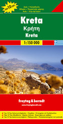
Freytag double-sided, folded road and leisure map of Crete, Greece at 1:150,000 with booklet outlining the top ten sights, some city maps, index with postal codes and colour photos. Map insets are for: Iraklio, Ag. Nikolaos, Hania, Rethimno, Malia, Zakiro, Festos, Ag. Triada and Knosos. Great quality travel map to buy for your trip to Crete, Greece.
Crete in a series of Top 10 Tips maps from Freytag and Berndt covering Europe’s popular tourist destination at 1:150,000, on a double-sided map with street plans, plans of main archaeological sites, and a booklet with brief, multilingual descriptions of the island’s 10 best locations and places of interest.
Topography is shown by bold relief shading with spot heights and names of mountain ranges, peaks, etc. Road network includes a selection of small local tracks and highlights scenic routes.
Picturesque towns and villages are highlighted and a range of icons mark various places of interest, including archaeological sites, churches, museums, marinas, campsites, youth hostels, golf courses, etc. The island’s 10 best sights are prominently marked and given brief multilingual descriptions in a booklet attached to the map cover.
All place names are shown in both Greek and Latin alphabets. The map has latitude and longitude lines at intervals of 10’. Map legend and the descriptions of main sights include English.
Also included are street plans of central Iraklion, Rethymnon, Chania and Aghios Nikolaos, plus plans of the archaeological sites at Knossos, Festos, Aghia Triada, Zakros and Malia.


