 Loading... Please wait...
Currency Displayed in
- Home
- Canadian Hydrographic Nautical Charts/Maps
- Pacific Coast
- 3813 - Port Louis and Otard Bay
Categories
3813 - Port Louis and Otard Bay

Hover over image to zoom
Product Description
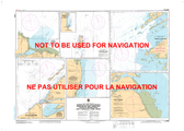
Port Louis and Otard Bay CHS Nautical Chart CHS 3813
Scale: 1 : 12000
Nautical Charts of Canada by the Canadian Hydrographic Service (CHS) for the navigation of Canadian waters & waterways. Whether it be commercial or for leisure these are the official charts by the CHS. GoTrekker Maps orders directly from the CHS and generally receives the charts within a week of the customer's order for reshipping. Charts are shipped folded by default.
If you need charts shipped rolled in a tube this is possible but please email a list of charts required with a ship to address so an approximate shipping cost can be obtained.
GoTrekkers orders Canadian Nautical & Topographic Charts directly from the Canadian Hydrographic Service (CHS) for retailers.
Click here to view a PDF version of our Pacific Coast index map. (large download)

