 Loading... Please wait...
Currency Displayed in
- Home
- Maps By Sport
- Canoe Maps Canada
- Clearwater River - Lloyd Lake to Fort McMurray Map Set
Categories
Clearwater River - Lloyd Lake to Fort McMurray Map Set
Product Description
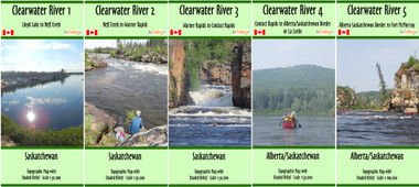
Clearwater River maps from Lloyd Lake to Fort McMurray
The maps include campsites, rapids information, inserts showing major rapids at a larger scale, portages, and points of interest and potential start/end points along the river with shaded relief.
1. Lloyd Lake to Neff Creek, scale of 1:50,000, dimensions 41.5 x 25 inches
2. Neff Creek to Warner Rapids, scale of 1:50,000, dimensions 41.5 x 25 inches
3. Warner Rapids to Contact Rapids, scale of 1:50,000, dimensions 41.5 x 19 inches
4. Contact Rapids to Alberta/Saskatchewan Border or La Loche, scale of 1:50,000, dimensions 36.3 x 25.25 inches
5. Alberta/Saskatchewan Border to Fort McMurray, scale 1:100,000, dimensions 41.5 x 10 inches
The maps are printed on paper and folded into protective plastic sleeves


