 Loading... Please wait...
Currency Displayed in
- Home
- Maps By Sport
- Hiking Maps
- Chilliwack West map
Categories
Chilliwack West map
Product Description
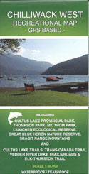
Map of Chilliwack West, BC, Canada, scale 1:30,000.
The first ever accurate GPS-based recreational map of the Chilliwack West (Skagit Range) area including access roads and highways, forest service roads, tracks, trails and mountaineering routes (MR). Roads and trails are qualified to enable best route finding.
Includes Cultus Lake Provincial Park, Luimchen Ecological Reserve, Great Blue Heron Ecological Reserve, Thompson Park, Mt. Thom Park, and the Vedder Mountain area. For camping, hiking, boating, mountain biking, fishing, whitewater kayaking, rafting, and mountaineering activities. Also for motorized activities including 4-wheeling, quad riding, and dirt biking.


