 Loading... Please wait...
Currency Displayed in

- Home
- Maps By Sport
- Hiking Maps
- Jasper National Park - Skyline Trail
Categories
Related Products
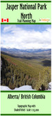


Jasper National Park - Skyline Trail

Hover over image to zoom
)
Product Description
Skyline Trail located in Jasper National Park
Map is 14"x 41.5", 1:40,000 with shaded relief
Shows the trail, campsites, trailheads, pull off parking areas, and accommodations.
Contour interval: 25m & 100m
Printed on paper the map comes folded in a protective plastic sleeve.
The Skyline Trail is Jasper’s most popular backcountry hiking trail and books up quickly. The most popular direction to hike the Skyline is Northbound from (Maligne Lake) to Jasper, since you lose more elevation that you gain. Most hikers travel the Skyline Trail in 2 – 3 days, though it’s nice to have an extra day to explore the alpine areas along the way. Highlights include Little Shovel Pass at km 10.3, Big Shovel Pass at km 17.5, the high col named “The Notch” and the alpine ridge hiking beyond. Snow can persist late into the summer season on this high elevation trail.
Weight: 35 grams