Loading... Please wait...

Categories

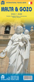
Malta Gozo Travel Map

Hover over image to zoom

  • Malta and Gozo on a road map at 1:30,000 from Freytag & Berndt with a booklet attached to the cover containing an index, street plans of Valetta, Bugibba and Rabat, plus descriptions of best sights prominently highlighted on the map. 

Topography is vividly presented by contours at 20m intervals, with altitude colouring and bold additional shading and graphics to highlight steep and rocky areas, particularly along the coastline. Road network includes country tracks, indicates scenic routes, shows locations of fuel supplies, and gives driving distances on main and secondary roads. The map also highlights many hiking trails. Ferry lines between the three islands and within the Valletta harbour are also shown. Best sights on Malta, Gozo and Comino are prominently marked, with their photos and descriptions provided in the booklet attached to the map cover. Large icons indicate various other places of interest and tourist facilities: campsites, churches, monasteries and pilgrimage sites, windmills, castles and museums, caves, golf courses, marinas, etc. The map has a UTM grid for GPS navigation. 

The index booklet also provides street plans of Bugibba, Rabat with an additional enlargement of its old town, plus a multi-page plan of Valetta, also with an enlargement of its historic centre. Map legend and all the text include English.
Freytag
$11.95
SKU:
AK93
Weight:
0.20 KGS

 Product Description

Freytag folded road map of Malta & Gozo at 1:30,000 with city map inset for Valletta and Sliema, tourist information and yacht supply stations. Best quality travel map to buy for your vacation trip to Malta and Gozo.

Malta and Gozo on a road map at 1:30,000 from Freytag & Berndt with a booklet attached to the cover containing an index, street plans of Valetta, Bugibba and Rabat, plus descriptions of best sights prominently highlighted on the map. 

Topography is vividly presented by contours at 20m intervals, with altitude colouring and bold additional shading and graphics to highlight steep and rocky areas, particularly along the coastline. Road network includes country tracks, indicates scenic routes, shows locations of fuel supplies, and gives driving distances on main and secondary roads. The map also highlights many hiking trails. Ferry lines between the three islands and within the Valletta harbour are also shown. Best sights on Malta, Gozo and Comino are prominently marked, with their photos and descriptions provided in the booklet attached to the map cover. Large icons indicate various other places of interest and tourist facilities: campsites, churches, monasteries and pilgrimage sites, windmills, castles and museums, caves, golf courses, marinas, etc. The map has a UTM grid for GPS navigation. 

The index booklet also provides street plans of Bugibba, Rabat with an additional enlargement of its old town, plus a multi-page plan of Valetta, also with an enlargement of its historic centre. Map legend and all the text include English.

 Find Similar Products by Category

You Recently Viewed...


newsletter

Copyright 2024 GoTrekkers. All Rights Reserved.
 Sitemap | Ecommerce Website Design by High Country Web Design.