 Loading... Please wait...
Currency Displayed in

- Home
- Maps By Sport
- Hiking Maps
- Lauca National Park Chile Trekking Map
Categories
Related Products
-
-
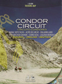
 Llanquhue Chile Trekking Map $12.95
 -
-

-


Lauca National Park Chile Trekking Map

Hover over image to zoom
)
Product Description
This 1: 100,000 scale map collects all the material published in Andeshandbook related to Lauca National Park.
characteristics
- Scale 1: 100,000
- Level curves every 100 m
- GPS compatible
- Triple grid: UTM (every 4000 m), geographical and quadrant coordinates
- Waypoint table
- UTM coordinate system, WGS84 datum
- Printed on stone paper for durability and water resistance
information
- It covers much of the Lauca National Park.
- 12 information sheets and a section on altitude sickness.
- A total of 17 routes of mountain routes and trekking tracked on the ground by experts.
- Camp sites and main attractions.
- Table with 21 GPS waypoints corresponding to different milestones of the described routes.
- Table of recommendations for environmental care and safe practice.
- Approximate times and distances for sections
Routes described
- Las Cuevas Interpretive Trail (trekking)
- Parinacota Interpretive Trail (trekking)
- Cotacotani Lagoons Trail (trekking)
- Route through the south face to Tarapacá hill
- Normal route to Guaneguane hill
- Route on the north face and south face to the Pomerape volcano
- Route on the north and west faces of the Parinacota volcano
- Route north face to Guallatiri volcano
- Route through south ridge to Acotango hill