 Loading... Please wait...
Currency Displayed in

- Home
- Maps By Sport
- Canoe Maps Canada
- Churchill River 11 - Iskwatam Lake to Sandy Bay map - SYNTHETIC
Categories
Related Products


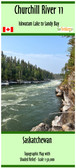


Churchill River 11 - Iskwatam Lake to Sandy Bay map - SYNTHETIC

Hover over image to zoom
)
Product Description
Churchill River 11 - Iskwatam Lake to Sandy Bay, Saskatchewan map.
Has a scale of 1:50,000 with shaded relief. The map size is 41.5"x25"
Shows the suggested canoe route with campsites, rapids/portage information, and points of interest. The map includes forest fire burns areas from the past decade
Printed on synthetic/waterproof paper, the map comes in a protective plastic sleeve
Updated with the help of the Churchill River Canoe Outfitters Staff 2023.